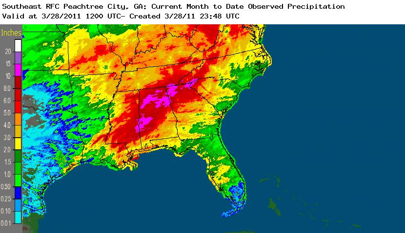
After a few days of chilly and rainy/cloudy days, skies clear for the day with plenty of sun and it should stay that way for the rest of this Tuesday. Highs will be from the mid 50s to lower 60s after hitting the low 30s last night with frosts and freezes scattered about. Tonight the temperatures will drop back into the 40s with increasing cloud development, a sign of our next approaching storm system that will come in and bring us more rain to contend with including some potential thunderstorms but that will most likely (at this point) be further south and west of the Carolinas across MS, AL, GA, and parts of TN possibly. Speaking of which, this chart here shows just how much rain and storms have been parading through those states. Very incredible amounts of rainfall racking up for this month:
After tomorrow, the chances for rain will continue for a part of Thursday and even as we dive into Friday, as the last system will swing on by the Southeast and finally clear out to allow for a nice weekend to unfold. For those of you who are not a fan of getting all of this rain, just hang in there. We're almost done with it.
Enjoy the day.
No comments:
Post a Comment