Ever since the great run of the 0z Euro, most, if not all of the modeling is now showing similar southerly solutions with the track of our next storm system. The only one that doesn't seem to go as far south is the OP run of 12z GFS, but even that one trended a bit further south. As for the rest of the 12z runs, the Canadian, 12z GFS ENS, and UKMET are all showing that southward trend that the Euro did but not as robust with the system.
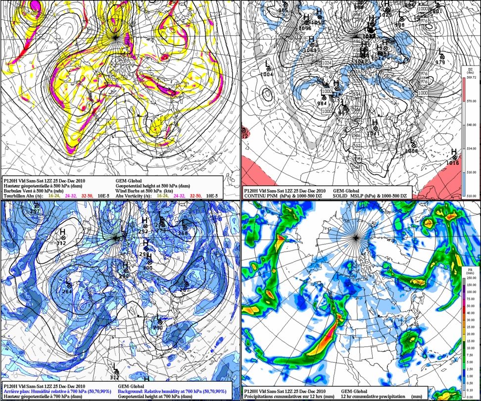
12z Euro came in very similar to its 0z run. Our system takes nearly the exact same track (From Mobile toward and along the NC coast). Our 850 temperatures are also a bit colder as well, so that's a plus (3°C colder to be precise). The low sits just a bit east of Mobile AL at 120hrs., really deepening itself as it gets ready to make a run in a NE direction. At 144hrs., the low is sitting at 996mb around Cape Hatteras, so eastern NC is getting nailed at that point. Temperatures are below freezing as well across the CLT region (ranging mid-upper 20s). Despite the .50-.75 qpf totals, none of us should worry about that since we're a few days away from the event, but even if it was to be a bit of an issue, the snow ratios are looking decent enough that you can get several inches of snow. Overall, I'm impressed that this run came in the way it did. Not completely excited yet, but we have a lot of the table that's coming together for a decent chance of a White Christmas across parts of the SE
Canadian 12 hr. cumulative precipitation (120hrs.) : http://www.americanwx.com/bb/uploads/monthly_12_2010/post-25-0-60598300-1292865039.jpg
Canadian P-type at 120hrs.: http://collaboration.cmc.ec.gc.ca/cmc/cmdn/pcpn_type/2010122012/I_nw_g1_EST_2010122012_114.png
12z GFS ENS: http://raleighwx.americanwx.com/models/gfsensemble/12zgfsensemblep12120.gif
12z Euro (120 and 144): http://raleighwx.americanwx.com/models/euro/12zeuro850mbTSLPUS120.gif
http://raleighwx.americanwx.com/models/euro/12zeuro850mbTSLPUS144.gif
No comments:
Post a Comment